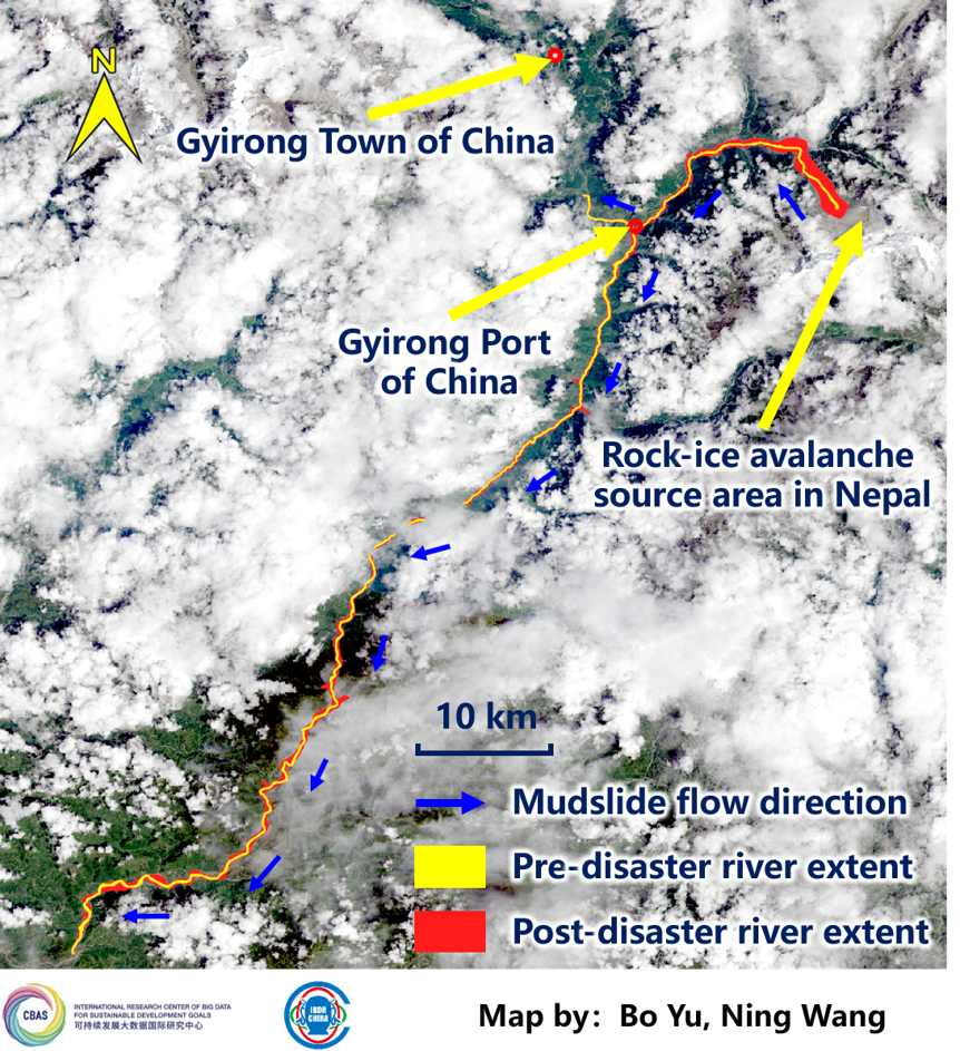
At approximately 10:30 a.m. Beijing Time on August 26, 2026, a major mudslide disaster occurred in the Donglin Zangbo River Basin along the China–Nepal border, severely affecting Gyirong Port in China. Following the disaster, a joint team from the International Research Center of Big Data for Sustainable Development Goals (CBAS) and the Integrated Research on Disaster Risk (IRDR) National Committee of China, further analyzed domestic and international satellite imagery to assess the mudslide-affected area. The monitoring results show that:
(1) Mudslide-induced floodwaters rapidly moved downstream along the river valley and caused significant upstream backflow. From Gyirong Port, the floodwaters backed up approximately 4.9 km upstream along the Gyirong Zangbo River, with the backflow front located about 14 km from Gyirong Town, China. The water covered area in the backflow zone increased from approximately 0.27 km² before the disaster (August 12) to approximately 0.62 km² after the disaster (12:48 p.m., August 26, Beijing Time), reaching 2.3 times the pre-disaster level.
(2) Mudslide-induced floodwaters caused substantial widening of the river channel. The river channel widened markedly along a 97.2 km stretch downstream from the rock-ice avalanche source area, with significant changes observed in local riverbanks. The river water area increased from approximately 6.39 km² before the disaster (August 12) to approximately 30.99 km² after the disaster (12:48 p.m., August 26, Beijing Time), reaching 4.85 times the pre-disaster level.